What is an Information Management System and how is it used?
Introduction
The system provides the means to record, store, search and summarise important data of various types (e.g. document, photos, video, files) relating to particular areas of interest, for example sites, traditional knowledge or ecological communities. The built-in mapping interface allows locations to be recorded and managed. References to people, flora and fauna species that do not relate to a particular location can also be recorded. Data within the system can be related to other relevant content, producing a valuable and structured resource for management.
The system is accessible only to individuals that have registered and been assigned a username and password. Each set of data entered into the system requires visibility permissions to be set that control which other user groups are able to view and edit the information. Users are able to enter data collected from the field manually or in bulk by using a set of import tools and procedures.
Security
The security and protection of sensitive information is central to the design of this system. Each user with access to the system is assigned a role, which determines whether the user has the authority to add, edit and/or delete information or simply to just view information.
Users are required to authenticate prior to accessing the system, after which access to content is based around their assigned user groups. All users within a particular user group can access content entered into the system, as defined by the person making the entry (see How do I set visibility permissions for an entry?).
Each approved user maintains a user profile, containing their contact details; system administrators and user account managers can control each user's system role and user groups (see How do I manage user accounts?). For example, user groups may exist for genders, workgroups, clans and/or families. The user can edit their profile and change their password by clicking on their name in the top-right of the screen (once logged in).
For more detail about the steps, see How do I login to the system?

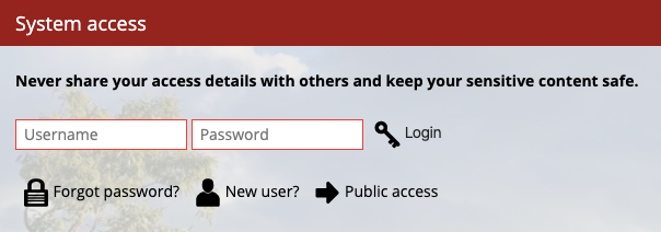
System login screen.
Navigating the system
There are several ways to browse and access information while using the system. The main menu located in the header area divides system content into several key areas called 'tabs'. These include information categories, as well as system settings and your user profile.
The search box is always available in the top-right of the screen. Use this to find particular items within the system. The results will show all content containing any reference to the term searched for. This search tool lets users quickly find information in the system that they are entitled to see. Only results that the user has permission to view will be returned.
For a more detailed set of instructions, see How can I navigate around the system?
Mapping
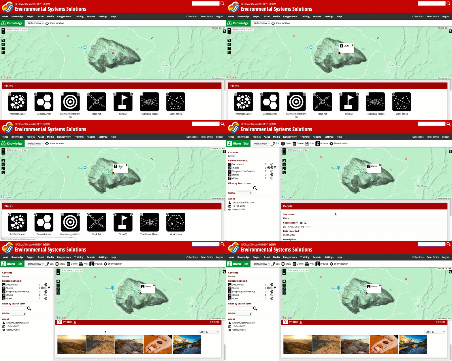
The map provides tools for zooming and panning the map and for selecting features from the map. It allows the user to see other entries that are nearby and obtain more information about those entries.
For more detailed instructions about how to find your way around the map and for working with the map, please refer to the following articles:

Navigating system content using the map representation.
Adding content
All content in the system is managed as an entry of a form. The form asks for a series of questions to be answered. Once the questions are answered, the user can choose who this information will be shared with.
Once complete, the user clicks [Create] to save the information. Each form contains a different set of questions, specific to the subject the form is about.
For more instructions on adding/editing, please refer to the following articles:
Reports
The Reports tab is where the information within the system gets summarised into useful formats. Reports or data summaries can extract specific pieces of information from the database, such as listing which assets need to be inspected in the coming months. System administrators can create additional reports. The reports can summarise any information entered into the system and can produce outputs such as tables, graphs, maps and datasets (e.g. GIS).
Details for all reports that are available to the current users can be downloaded or printed.
For a more detailed set of instructions, see How do I run a report?

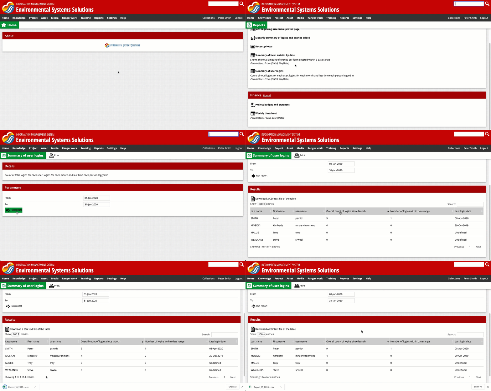
Running a report that summarises user logins in January 2020, and downloading the results.