Along the River Murray, ESS works with multiple units that are funded by the NSW Government, Murray Darling Basin Authority and Snowy Hydro.
Our work is partcularly with the Soil Conservation Service and has been a long relationship (>10 years of supporting their data management and programs).
- River Murray Works Unit
- The River Murray Works Unit manages the 200 km stretch of the River Murray between Hume Dam near Albury and the upper reaches of Lake Mulwala near Yarrawonga. We assist with managing the spatial and attribute information about their river assets and works, along with the various communications with landholders regarding when and where works can take place.
- Tumut and Upper Murray Works Unit
- ESS supports field data collection, content management and reporting for this works unit. We assisted with the integration of ESRI Field Maps into an online web application used for generating templated annual reports and other data products (e.g. program budgets, project proposals).
- Salf Inception Scheme
- ESS solutions are used for managing assets and the ongoing monitoring/maintenance of those assets for these MDBA schemes (see info on MDBA website). We also support their program with field data collection tools for their land management team.
Over the long relationship with these clients, ESS has provided advice, technology and customisations to assist with managing this data, specifically:
- Tools for field-based data collection
- Community-based monitoring techniques and training
- Data collection and storage for a variety of practitioners, researchers and landholders
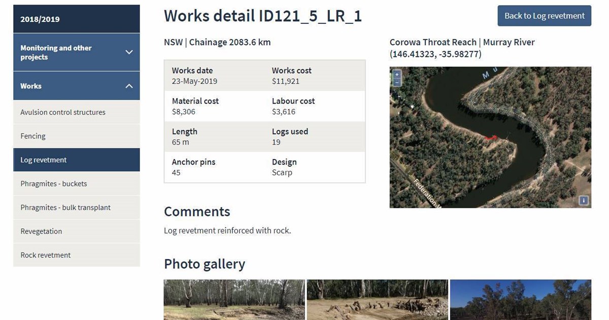
This allows 'on-demand' summary reports to be produced that describe the work completed. Through use of web-mapping and database management, ESS has provided the Works Unit with a single, accessible place for storing all their information, including:
- photos/videos;
- communications with landholders;
- spatial extent of the works installed;
- detailed attributes about the works;
- maintenance-focussed forms; and
- monitoring forms.
As a result of this data management approach, the teams are able to:
- quickly produce reports that describe and summarise the status of their assets;
- enter works information into their database 'in the field'
- share information between different members of the Works Unit; and
- see a complete picture of their assets in one, easy-to-navigate place.